The August 2026 Glacier Disaster in Nepal
On August 26, 2026, a catastrophic glacier and ice-rock collapse in the high Himalaya near the Nepal–Tibet border triggered one of the most devastating flood disasters Nepal has experienced in recent years. A huge mass of ice and rock fell into the Lhende River in Tibet, creating a temporary blockage before the water and debris surged downstream into Nepal. The flood entered the Lhende Khola, continued into the Bhote Koshi and then the Trishuli River, carrying enormous quantities of water, mud, rocks and debris through settlements and infrastructure.
The disaster struck with extraordinary speed. In the Trishuli River, water levels reportedly rose by as much as 9 metres in only 30 minutes. Communities along the river had little time to respond. Timure, Rasuwagadhi and Syabrubesi were among the hardest-hit areas in Rasuwa, while the flood and debris continued downstream through Nuwakot and Dhading and much farther along the Trishuli–Narayani river system.
This was not only a human tragedy. Houses, markets, hotels, vehicles, livestock, roads, concrete bridges, suspension bridges, hydropower projects, border facilities, businesses, public buildings and other infrastructure were damaged or swept away. The disaster also disrupted an important transport and tourism corridor connecting northern Nepal with Kathmandu.
The full consequences are still being discovered as rescue teams search through enormous quantities of mud and debris. The casualty figures are also changing rapidly. As of August 29, Nepal's disaster authorities were reporting 579 deaths and 1,924 people missing, including hundreds of foreign nationals and hundreds of hydropower workers. More than 3,700 people had been rescued, while tens of thousands of people were affected by the disaster.
What Happened on the Nepal–Tibet Border?
The Glacier and Ice-Rock Collapse
The disaster began high in the Himalaya on the Tibet side of the border. Satellite analysis and early investigations indicate that a large section of glacier and surrounding rock collapsed into the Lhende River, approximately 20 kilometres northeast of the Rasuwagadhi border crossing.
The enormous ice-and-rock avalanche blocked the river and created a temporary natural dam. When the blockage failed, a powerful surge of water and debris moved downstream. The event was initially associated with an earthquake because the collapse itself produced a seismic signal, but the United States Geological Survey later determined that the seismic signal came from the landslide rather than a conventional earthquake.
Scientists are still investigating the precise sequence and causes of the collapse. It is therefore important to distinguish the immediate physical trigger from the broader climate question. The disaster was caused directly by a massive mountain collapse and sudden release of water, while scientists are examining whether warming, glacier retreat, permafrost thaw and changing mountain stability contributed to the conditions that allowed such a collapse to occur.
Timure and Rasuwagadhi Were Hit First
The first major destruction in Nepal occurred around Timure and Rasuwagadhi in Rasuwa, close to the Nepal–Tibet border.
The flood swept through the border settlement with extraordinary force. Homes, shops, vehicles, warehouses, roads, bridges and border-related infrastructure were engulfed by water, mud and rocks. More than 300 trucks and other vehicles waiting around the customs area were reported to have been swept away during the initial disaster.
Rasuwagadhi is not an isolated mountain village. It is an important border gateway for trade and travel between Nepal and Tibet and lies on a major route used by local residents, transport workers, traders, tourists and pilgrims.
The destruction therefore affected both local families and a much wider network of people whose livelihoods depend on this corridor.
The Flood Swept Through Syabrubesi and Rasuwa
From the border area, the enormous flood continued downstream through the Bhote Koshi system, devastating communities in Rasuwa.
Syabrubesi and surrounding settlements were severely affected. Houses, markets, roads, bridges and other structures were damaged or destroyed. The flood also struck hydropower facilities and areas where workers were living and working along the river.
The suddenness of the event was one of its most frightening characteristics. There had been no ordinary rainfall event in the immediate area that could have prepared communities for a flood of this magnitude. People were going about their normal activities when an enormous wall of water, mud and debris arrived from upstream.
From the Lhende Khola to the Bhote Koshi and Trishuli
The flood's route explains why the disaster became so extensive.
Lhende River → Lhende Khola → Bhote Koshi → Trishuli → Narayani
After entering Nepal, the flood travelled through the Bhote Koshi and then into the Trishuli River. The Trishuli carried the disaster far downstream, affecting communities in Nuwakot and Dhading and sending floodwater and debris much farther into the river system. Bodies were later recovered far downstream, including in Gorkha, Tanahun and Chitwan and the Nawalparasi districts.
The Trishuli eventually joins the Narayani River, which flows south into India as the Gandak. This demonstrates how a high-mountain event near the Nepal–Tibet border can become a regional river disaster extending far beyond the original point of collapse.
The Extraordinary Speed and Force of the Flood
The most alarming feature of this disaster was not only the volume of water but also how quickly the river changed.
Nepali officials reported that the Trishuli River rose by as much as 9 metres within 30 minutes. Such a rapid rise leaves very little time for people to evacuate, especially in narrow Himalayan valleys where settlements, roads and infrastructure are concentrated close to rivers.
The flood was not clean water. It carried rocks, mud, trees, vehicles, construction material and other debris. This greatly increased its destructive power.
Survivors described the event as arriving almost like a wall of water. Buildings were rapidly inundated, bridges disappeared and roads became impassable. In some locations, thick layers of mud and debris buried buildings and vehicles.
The Human Cost: Lives Lost and People Missing
The greatest tragedy is the loss of human life.
As of August 29, Nepal's disaster authorities were reporting 579 deaths and 1,924 people missing. The missing include Nepali citizens, foreign nationals, security personnel, hydropower workers, local residents, travellers and tourists. The numbers remain provisional because search and identification operations are continuing.
The disaster also affected people travelling through the region toward Tibet and the Kailash–Mansarovar pilgrimage area. Hundreds of foreign nationals were among those reported missing, making the tragedy an international as well as a national disaster.
Every number represents a family waiting for information, a missing colleague, a friend, a neighbour or a loved one.
Bodies have been recovered from locations far downstream, demonstrating how powerful the flood was and how widely its effects spread. Identification and the return of remains to families are now part of the continuing emergency response.
Animals and Livestock Are Also Victims
The disaster should not be measured only by the human death toll.
Along the river valleys, many families depend on cattle, buffaloes, goats, sheep, poultry and other livestock. A sudden flood can destroy an entire family's livestock within minutes.
Animals can become trapped in homes, sheds and farms when there is no time for evacuation. Their loss can create a second disaster for rural households because livestock represents food, income, savings and future livelihood.
The loss of domestic animals and wildlife also forms part of the wider environmental damage caused by such a powerful flood.
Roads and Bridges: Nepal's Connectivity Severely Damaged
The destruction of transportation infrastructure has made the emergency much harder.
Early assessments reported dozens of bridges destroyed and around 40 kilometres of roads damaged or destroyed. Both major road bridges and smaller suspension bridges were affected.
These bridges are not simply pieces of infrastructure. In mountain Nepal, a single bridge can determine whether an entire community can receive food, medicine, fuel and rescue assistance.
The damage has therefore created a dangerous cycle:
Flood → bridges destroyed → roads cut → rescue delayed → supplies delayed → recovery becomes more difficult.
The disruption also affects long-term trade and tourism because the northern corridor is an important connection between the Nepal–Tibet border and Kathmandu.
Dhading, Malekhu and the Kathmandu Connection
The disaster's consequences extend well beyond Rasuwa.
As floodwaters travelled down the Trishuli system, areas of Nuwakot and Dhading were affected. The wider Trishuli corridor is one of the important road connections between northern Nepal and Kathmandu.
The Dhading Besi–Malekhu–Kathmandu connection and associated roads and bridges are important for local communities, tourism, trade and the movement of essential goods.
Damage in this corridor can therefore affect people who live far from the original flood zone. Even when their homes are not flooded, they may suddenly find themselves cut off from markets, hospitals, schools, government services and transportation.
Hydropower Projects and Nepal's Energy Infrastructure
The flood also struck one of Nepal's most important economic sectors: hydropower.
The Bhote Koshi and Trishuli valleys contain numerous hydropower projects because of their steep terrain and powerful rivers. Several projects and associated infrastructure were damaged by the flood. Hundreds of hydropower workers were also among those reported missing.
The loss therefore has two dimensions.
First, there is the immediate humanitarian tragedy affecting workers and their families.
Second, there is the economic cost of damage to generating stations, tunnels, transmission infrastructure, access roads and other facilities.
The disaster demonstrates that hydropower development in mountain valleys must be designed not only for ordinary floods but also for increasingly complex hazards involving landslides, glacier collapse, debris flows and sudden changes in river behaviour.
Homes, Businesses, Hotels and Private Property
Entire communities depend on the river corridors for their homes and livelihoods.
The flood destroyed or damaged houses, shops, hotels, restaurants, warehouses, vehicles, agricultural property and other private businesses. Some buildings were swept away completely while others were buried under mud and debris.
For affected families, the loss is not simply the cost of rebuilding a house.
A family may have lost:
- Its home
- Livestock
- Vehicle
- Shop or business
- Agricultural land
- Furniture and household belongings
- Important documents
- Savings and business stock
- Tools and equipment
- The ability to earn an income
For many families, recovery will take years rather than months.
Government Offices and Public Services
The disaster has also affected government offices, police and security facilities, local administration, schools, health services and other public infrastructure.
When roads, bridges, electricity, communications and public buildings are damaged at the same time, the normal system of government service delivery becomes extremely difficult.
Emergency workers themselves have also been among the victims. Security personnel have been deployed in large numbers for rescue, evacuation, security and recovery operations, while damaged roads and unstable slopes continue to make access difficult. More than 14,000 security personnel had been deployed in the response by August 28.
Tourism, Pilgrims and Visitors Caught in the Disaster
The Rasuwa–Kerung corridor is an important route for tourism, pilgrimage, trade and travel.
The region provides access toward Tibet and is used by travellers heading toward the Kailash–Mansarovar pilgrimage area. Foreign tourists, pilgrims, transport workers and local tourism businesses were therefore present when the disaster occurred.
The loss of roads, bridges, hotels, vehicles and border infrastructure will affect tourism well beyond the immediate disaster area.
For Nepal's tourism industry, this is another reminder that mountain tourism depends on resilient infrastructure, reliable early-warning systems and accurate information during emergencies.
The Environmental Damage
The flood also changed the landscape itself.
An enormous quantity of mud, rock, sediment, trees and other debris was carried downstream. Riverbanks were altered, agricultural land was buried and river channels changed.
Animals and ecosystems along the river corridor were affected, while vegetation and farmland were damaged or covered by sediment.
Such changes can continue creating hazards after the first flood has passed. Unstable slopes, debris-blocked rivers and newly formed temporary lakes can produce secondary floods and landslides.
Indeed, authorities and scientists have warned about additional flood risks from unstable water bodies and debris-blocked drainage systems in the mountains.
A Similar Warning Came From the Same River Corridor in 2025
The August 2026 disaster did not come completely without precedent.
On July 8, 2025, a sudden flash flood originating from a supraglacial lake on the Purepu Glacier in Tibet caused severe destruction along the Lhende River, known in Nepal as the Bhote Koshi. Nepal's official disaster situation report recorded deaths and missing people across Rasuwa, Nuwakot, Dhading and Chitwan along the Trishuli corridor.
The fact that another major event followed in the same broader river system only about a year later makes the current disaster especially significant.
It raises an important question:
Are the Himalayas entering a period in which communities need to prepare for more frequent and less predictable glacier-related disasters?
Nepal Has Faced Glacier Disasters Before
Nepal has a long history of glacier-related floods.
According to ICIMOD, Nepal has experienced more than 90 glacial lake outburst floods since the early 1920s. These events can release millions of cubic metres of water and debris within a very short period and can destroy communities and infrastructure downstream.
The danger is therefore not new.
What is changing is the condition of the high mountains.
Tsho Rolpa: One of Nepal's Most Dangerous Glacial Lakes
Tsho Rolpa in Dolakha is one of the best-known examples of Nepal's glacial-lake danger.
The lake has expanded significantly over the past decades as the surrounding glacier has retreated. ICIMOD describes Tsho Rolpa as a large potentially dangerous glacial lake and reports that it has continued expanding, with surrounding glacier ice calving into the lake. A potential outburst could threaten downstream communities, farmland, forests and infrastructure.
Risk-reduction work has already lowered the lake level, but monitoring remains necessary.
Tsho Rolpa is a powerful reminder that the danger does not have to come from a sudden collapse today. A glacial lake can gradually grow for decades while the risk downstream increases.
Imja Tsho in the Everest Region
Another major example is Imja Tsho in the Everest region.
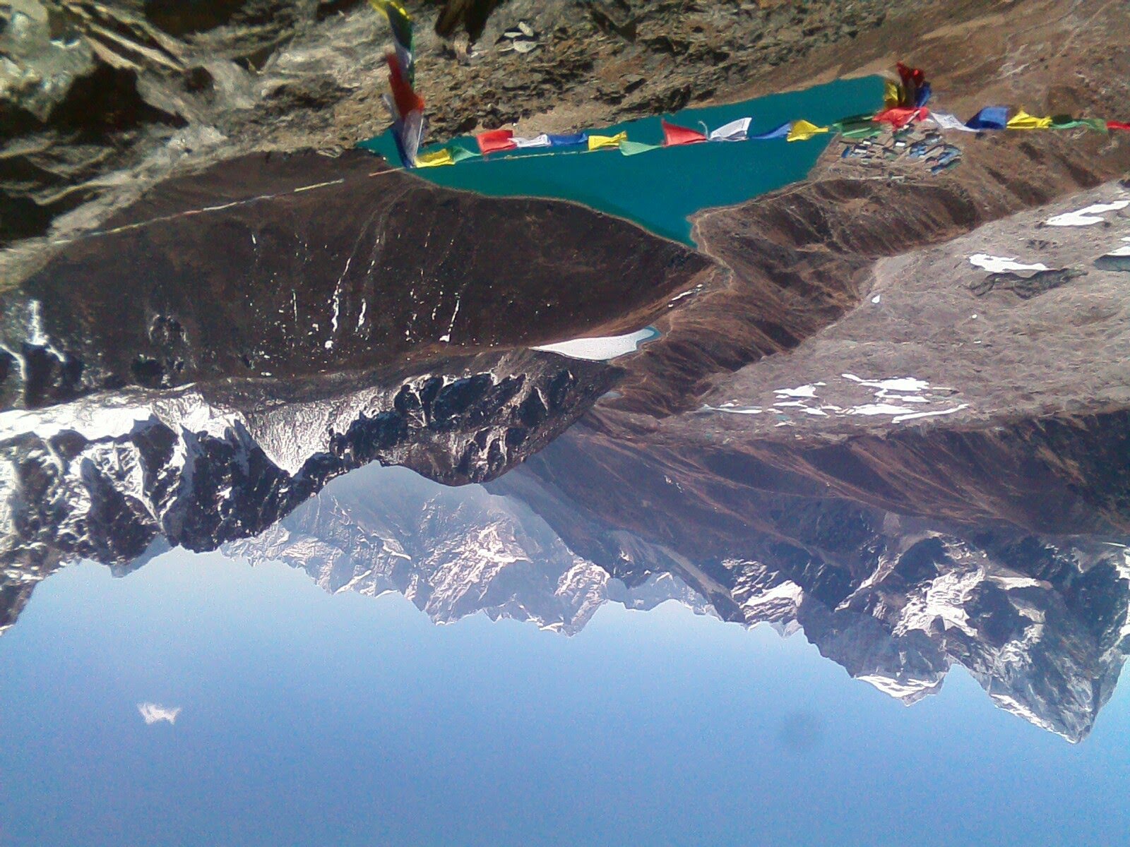
Imja Tsho formed from a collection of small supraglacial ponds beginning in the middle of the twentieth century and developed into a large moraine-dammed glacial lake. ICIMOD identifies it as one of the potentially dangerous glacial lakes in the Nepal Himalaya.
Because it lies in the Everest region, its risk is especially important for communities, trekkers, tourism infrastructure and settlements downstream.
Water-level reduction and risk-reduction measures have been undertaken at Imja Tsho, but continued monitoring remains essential.
The 1985 Dig Tsho Disaster
Nepal's history also includes one of the most important Himalayan GLOF disasters: the 1985 Dig Tsho glacial lake outburst flood in the Everest region.
The flood destroyed a newly constructed hydropower plant and caused extensive downstream damage. ICIMOD notes that the Everest region has experienced several significant glacial lake outburst events in recent decades.
This history shows that the threat of glacier-related flooding existed long before today's climate crisis became the dominant global environmental concern.
What Is Global Warming Changing in the Himalayas?
The current disaster has naturally renewed the question of climate change.
A warmer atmosphere can accelerate glacier loss, alter snow and ice conditions, contribute to the expansion of glacial lakes and affect the stability of frozen ground and mountain slopes.
ICIMOD reports that the Hindu Kush Himalaya is experiencing rapid glacier mass loss and that changing glaciers are contributing to the formation and expansion of glacial lakes. Its research identifies dozens of potentially dangerous glacial lakes across the region.
This does not mean that every individual avalanche, landslide or flood can automatically be attributed to global warming.
The scientific question is more complicated.
Climate change can alter the background conditions that make high mountain environments less stable, while individual disasters can still be triggered by earthquakes, rainfall, ice collapse, rockfall, lake-breach events or combinations of several factors.
The August 2026 disaster should therefore be understood as both a specific geological and hydrological event and a warning about the changing conditions of the Himalayan cryosphere.
Why the Risk Is Bigger Than One Glacier
Nepal and the wider Hindu Kush Himalaya contain thousands of glaciers and glacial lakes.
ICIMOD's regional inventory identified thousands of glacial lakes across the Hindu Kush Himalaya and ranked dozens as potentially dangerous. Tsho Rolpa and Imja Tsho remain among the highest-priority examples in Nepal.
This means Nepal cannot prepare only for one lake or one valley.
Risk monitoring needs to cover:
- Glaciers
- Glacial lakes
- Moraine dams
- Permafrost and unstable slopes
- River channels
- Landslide-dammed lakes
- Hydropower infrastructure
- Roads and bridges
- Downstream settlements
What Nepal Needs to Do Now
The August 2026 disaster should become a major lesson for Nepal's disaster-preparedness system.
Better Glacier and Glacial Lake Monitoring
Remote sensing, satellite imagery, drones and field surveys can help identify changes in glaciers, lakes and unstable mountain slopes before they become catastrophic.
Stronger Early-Warning Systems
People downstream need warnings that reach them within minutes, not hours or days.
Sirens, mobile alerts, radio communication, local warning networks and automated river monitoring can all save lives.
Climate-Resilient Roads and Bridges
Roads and bridges in high-risk valleys should be designed with extreme flood and debris-flow scenarios in mind.
A bridge that survives ordinary monsoon flooding may not survive an enormous glacier-related debris surge.
Safer Hydropower Planning
Hydropower is essential to Nepal's future, but projects need stronger assessment of glacier-related hazards, landslides, debris flows and sudden changes in river behaviour.
Stronger Cooperation Across the Himalayas
The August 2026 event began on the Tibet side and caused devastating consequences in Nepal.
That makes cross-border information sharing and early warning essential.
Nepal, China and other Himalayan countries need mechanisms for sharing satellite observations, glacier and lake monitoring information and emergency warnings as quickly as possible.
How Can We Help the Victims of the Nepal Disaster?
The immediate priority is to help affected families, rescue missing people, provide food and water, restore medical services and begin rebuilding destroyed communities.
People in Nepal and people living abroad have been looking for safe and reliable ways to contribute.
Help Through the Official Prime Minister Disaster Relief Fund
The Government of Nepal has issued an official appeal requesting financial support from inside and outside Nepal through the Prime Minister Disaster Relief Fund (प्रधानमन्त्री दैवी प्रकोप उद्धार कोष).
The Office of the Prime Minister and Council of Ministers provides official domestic and overseas payment channels, including information for contributions through Nepal Clearing House Limited (NCHL) and Himalayan Bank, as well as official QR-code information.
Official government information and donation channels:
Office of the Prime Minister and Council of Ministers – Prime Minister Disaster Relief Fund Appeal
Helping From Within Nepal
People and organizations in Nepal can contribute through the official payment channels published by the Government of Nepal.
Before making a payment, carefully check that the QR code, account number or payment method matches the information provided on the official government page.
Helping From Outside Nepal
Nepalis and other supporters living overseas can also contribute to the relief effort.
The Government of Nepal's official appeal provides overseas contribution channels, including NCHL and Himalayan Bank. Donors outside Nepal should use the official government information rather than sending money to an account or QR code shared anonymously through social media.
Be Careful With Fake Relief Appeals
During a major disaster, genuine people need help — but disasters can also attract fraudulent fundraising.
Do not automatically trust a QR code, bank account, social-media post or fundraising message simply because it uses photographs of victims.
Verify before donating.
The safest approach is to use the official government relief-fund information or the verified website of a recognized humanitarian organization.
The Road to Recovery Will Be Long
Rescue is only the first stage.
After missing people are located and immediate medical needs are addressed, affected communities will need to rebuild homes, roads, bridges, schools, health facilities, businesses, hydropower infrastructure and livelihoods.
Some families will need temporary accommodation. Others will need long-term support to rebuild their businesses and replace livestock and agricultural assets.
The restoration of roads and bridges will be particularly important because communities cannot fully recover while they remain isolated.
The economic consequences may also extend far beyond Rasuwa. Tourism, trade, transport, hydropower, construction, agriculture and local businesses throughout the Trishuli corridor may feel the effects during the recovery period.
A Warning From a Changing Himalaya
The August 26 disaster is a painful reminder that Nepal's mountains are not static.
The Himalayas are shaped by moving glaciers, changing rivers, unstable slopes, expanding glacial lakes and rapidly changing climatic conditions.
For generations, Nepal has lived with natural mountain hazards. But the combination of rapid glacier change, warming temperatures, growing infrastructure and settlements in narrow valleys, hydropower development and increasing exposure creates a new level of risk.
The answer is not to fear the Himalayas.
The answer is to understand them better, monitor them more carefully and prepare communities before disaster strikes.
Tsho Rolpa, Imja Tsho, Dig Tsho, the 2025 Lhende/Bhote Koshi flood and the catastrophic August 2026 disaster all provide different lessons.
The most important lesson from the latest tragedy is simple:
A disaster that begins high in the Himalayas can travel far downstream and affect people, animals, communities, tourism, energy, roads, bridges and the wider economy.
Nepal must therefore treat glacier and mountain hazards as a national priority — and Himalayan countries must work together to make sure that the next warning reaches downstream communities before the water arrives.
Frequently Asked Questions
Is the entire country of Nepal affected by the August 2026 disaster?
No. The most serious impacts are concentrated along specific river corridors and nearby communities. Conditions vary considerably across Nepal, so travellers should check the latest information for their particular destination and route.
Will the damaged roads and bridges be restored?
Yes. Restoring connectivity is a major part of the recovery. Temporary Bailey bridges and other emergency measures can reconnect isolated communities while permanent roads and bridges are rebuilt.
Will the affected areas return to normal after the monsoon?
Recovery will take time, but restoration and reconstruction will continue as conditions allow. Once the monsoon ends and weather and ground conditions become more suitable for major construction, rebuilding work can move forward more effectively.
Can people outside Nepal contribute to the relief effort?
Yes. People living abroad can support affected families and communities through the official Prime Minister Disaster Relief Fund and other verified humanitarian channels. Always confirm the official payment details before making a contribution.
Is Nepal still welcoming visitors?
Yes. Nepal continues to welcome visitors, although particular routes or areas may experience temporary disruption because of infrastructure damage or local conditions. Travellers should check the latest information for their intended destination and route before travelling.
How You Can Stand With Nepal
Nepal is a country loved by people from around the world. Every year, travellers, trekkers, mountaineers, pilgrims and visitors come to experience its mountains, meet its people and share unforgettable moments with Nepali communities. Many who have visited Nepal leave with a lasting connection to the country and its people.
Today, Nepal needs that friendship and support more than ever.
The recent disaster has taken lives and destroyed homes, roads, bridges, businesses, hydropower projects, livestock and essential infrastructure across affected Himalayan communities. Many families are facing the loss of loved ones, homes, livelihoods and everything they had built.
Mountain King Treks sincerely appeals to everyone who loves Nepal and the Nepali people to stand with the families and communities affected by this tragedy.
If you would like to help, we strongly encourage you to contribute directly through the official Prime Minister Disaster Relief Fund of the Government of Nepal. This is the appropriate national relief channel for supporting people affected by major disasters in Nepal.
Whether you are in Nepal or living abroad, every genuine contribution can help provide emergency assistance and support the long process of recovery and rebuilding.
Please use only the official government relief channels and verify the payment details before making a contribution. During a major disaster, unofficial accounts and fraudulent QR codes can also circulate on social media.
Official Prime Minister Disaster Relief Fund:
Office of the Prime Minister and Council of Ministers – Official Relief Appeal
For anyone planning to visit Nepal, understanding the country and preparing responsibly are also important. Our Nepal Travel Information Guide, Nepal Travel Planning Guide, and Nepal Trip Preparation Guide provide practical information to help travellers understand destinations, plan their journeys and prepare for travel in Nepal.
A Message From Mountain King Treks
We have spent decades working in Nepal's mountains and meeting people from many countries who have come to know and love Nepal. We have seen how deeply visitors connect with our mountains, villages and people.
This is a time when that connection can become meaningful support.
To everyone who has travelled through Nepal, trekked in its mountains, climbed its peaks, visited its heritage sites, met its people or simply carries Nepal in their heart — please consider extending a helping hand.
Even a small contribution, when thousands of people come together, can make a meaningful difference.
Nepal Will Rise Again
The August 2026 disaster has left a painful mark on Nepal. The loss of life cannot be replaced, and the damage to homes, communities and infrastructure will take years to fully recover.
But Nepal has always been a country of resilient people.
The mountains will remain. The rivers will continue to flow. Communities will rebuild their homes and livelihoods, roads and bridges will be reconstructed, and visitors from around the world will once again travel through Nepal's valleys and mountains.
What Nepal needs now is solidarity, responsible support and helping hands from within the country and from around the world.
Let us remember those who lost their lives, support those who are searching for loved ones, stand beside families who have lost their homes and livelihoods, and help affected communities begin their long journey toward recovery.
If you love Nepal and the Nepali people, this is a time to stand with them.